| Hawkeye 1000 Series |
| The Hawkeye 1000 range is the result of ARRB’s extensive research into
pavement and asset management. The economic benefits of the 1000 Series and fit for purpose specifications make it an ideal solution for both video and road profiling applications. Most importantly, the 1000 Series is fully compatible with other Hawkeye products, enabling full data integration across the entire range. Our advanced research and development program ensures we provide our clients the best products, utilising the latest research and technologies. Collecting accurate, time stamped data is assured in Hawkeye through the use of our innovative development, Heartbeat. The Heartbeat module ensures that all data is accurately linked to a primary key and allows for the integration of current and future data acquisition modules, meaning seamless upgrades of your equipment. |
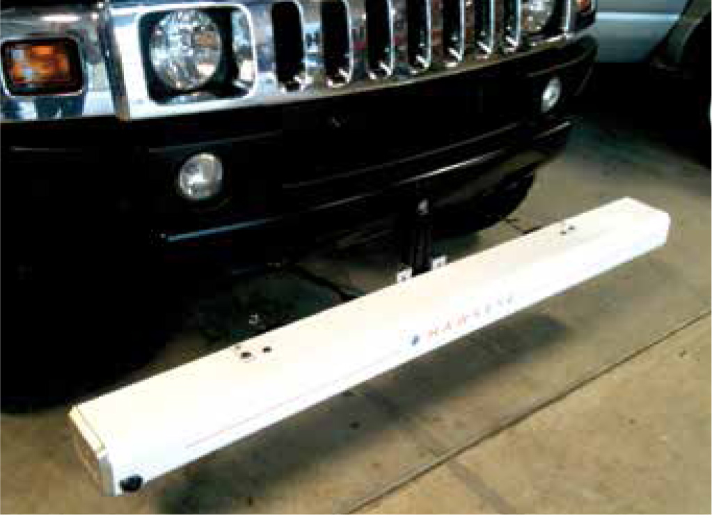
| H1000 Digital Laser Profiler |
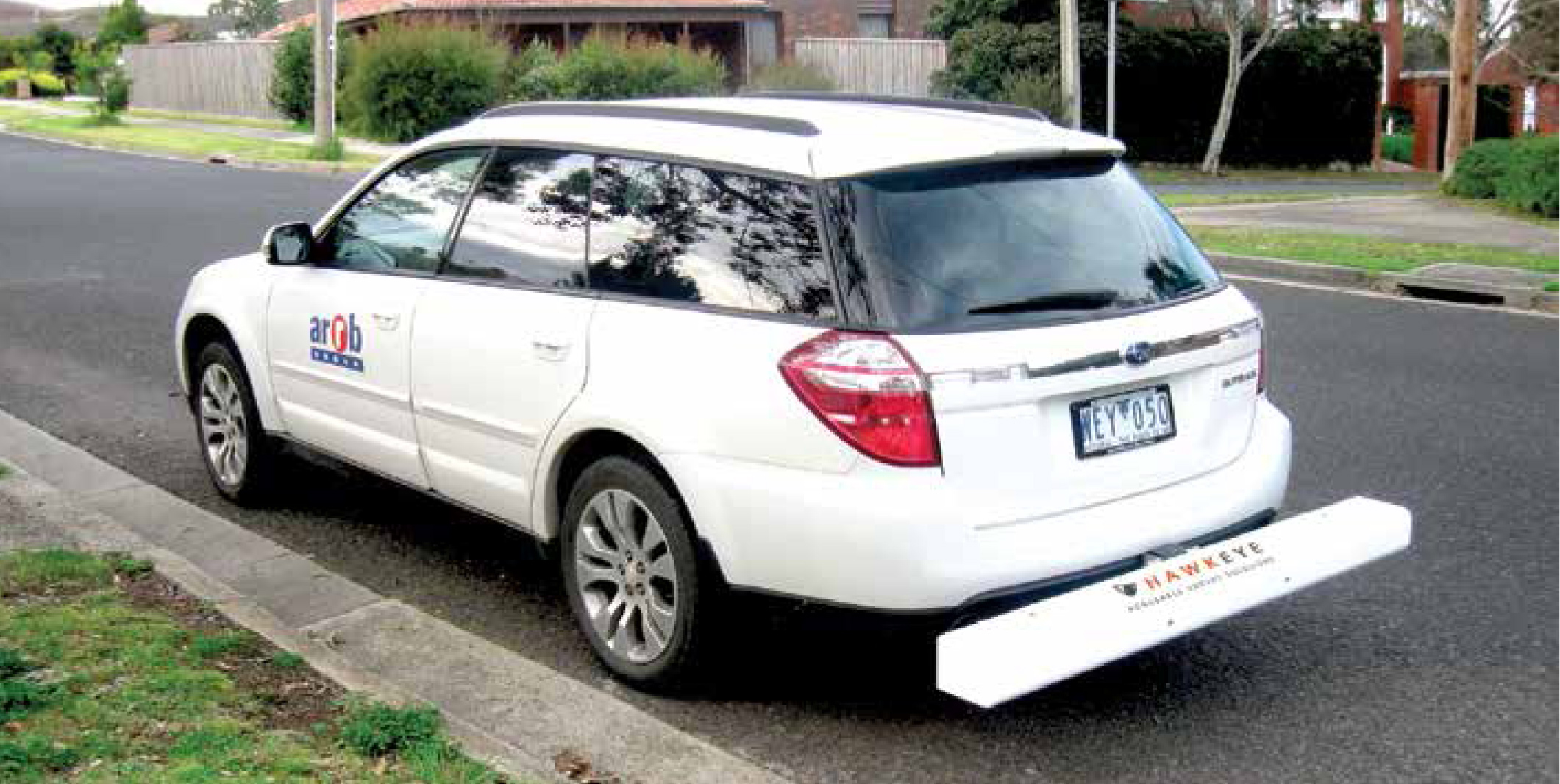
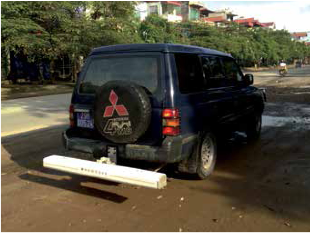
| The H1000 Digital Laser Profiler (DLP) measures longitudinal
profile, roughness and macrotexture (MPD and SMTD). A World Bank Class 1 profiler, the H1000 DLP measures road profile using accelerometers and precision laser sensors, to compensate for vehicle body movement. The DLP is completely portable , utilising a detachable beam that comes complete with a tow-bar mounting kit, making it perfect for less frequent survey demands. An accurate Distance Measuring Instrument (DMI) and the Heartbeat module are used to precisely link the data to distance measurements. Used in conjunction with the Hawkeye Processing Toolkit, you have the ability to produce tables, graphs, reports and exports from your collected data. The H1000 DLP is capable of supporting up to two digital imaging cameras, DGPS and a Gipsi-Trac Geometry system. |
|
| Features |
|
| Applications |
|
| Available outputs |
|
| Compliance with standards |
|
|
| H1000 Digital Imaging System |
|
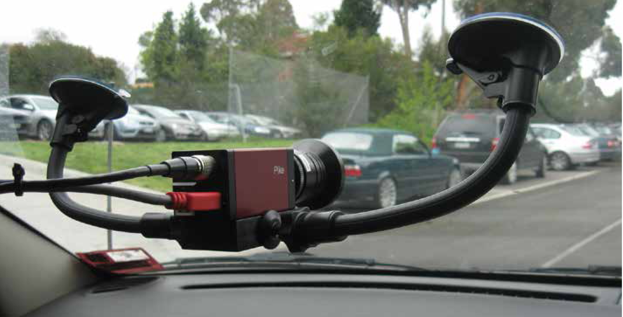
The H1000 Digital Imaging System (DIS) is an imaging unit for visually capturing and locating roads and roadside features. |
|
The single, full high definition (HD), colour camera can
be mounted on a windscreen or vehicle dashboard. |
|
| Features |
|
| Applications |
|
| Available outputs |
|
|
| Hawkeye 1000 DUO |
|
The first completely portable road and asset data collection system, with multiple configuration options. |
|
The H1000 DUO is perfect for project level data
collection demands, as well as larger scale network
surveys. The system is capable of collecting longitudinal
profile, roughness and macrotexture (MPD and SMTD),
whilst providing fully-linked video images. |
|
| Features |
|
| Applications |
|
| Available outputs |
|
| Compliance with standards |
|
|
| H1000 Gipsi-Trac Geometry |
|
The Gipsi-Trac Geometry System uses a combination of inertial sensors to collect road geometry information. |
|
The unit includes the Gipsi-Trac microprocessor-based
system, which records and combines inertial data from a
gyroscope, accelerometer and distance sensor with GPS
position. The built in dead-reckoning capability allows
for position data to be recorded when in tunnels, under
bridges and locations with little or no GPS coverage. |
|
| Features |
|
| Applications |
|
| Available outputs |
|
|
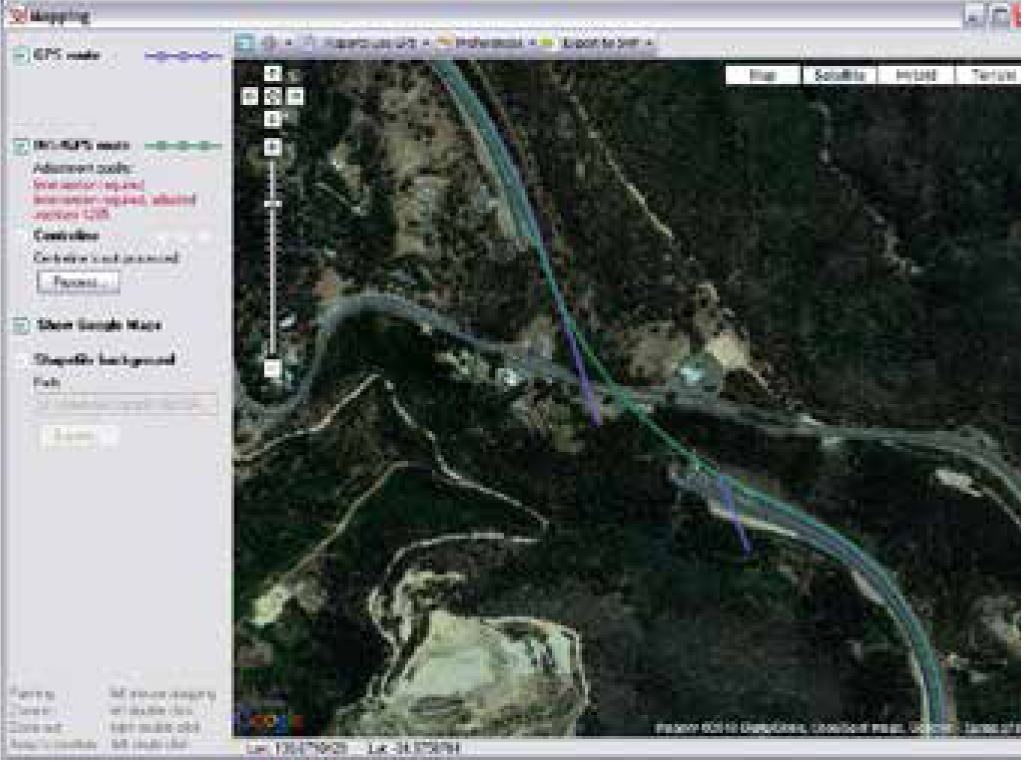
| Hawkeye Software Suite |
|
The Hawkeye software suite is a professional and powerful acquisition and data analysis combination. |
| Onlooker Live - Acquisition software |
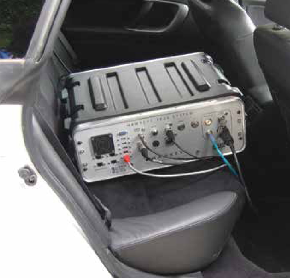
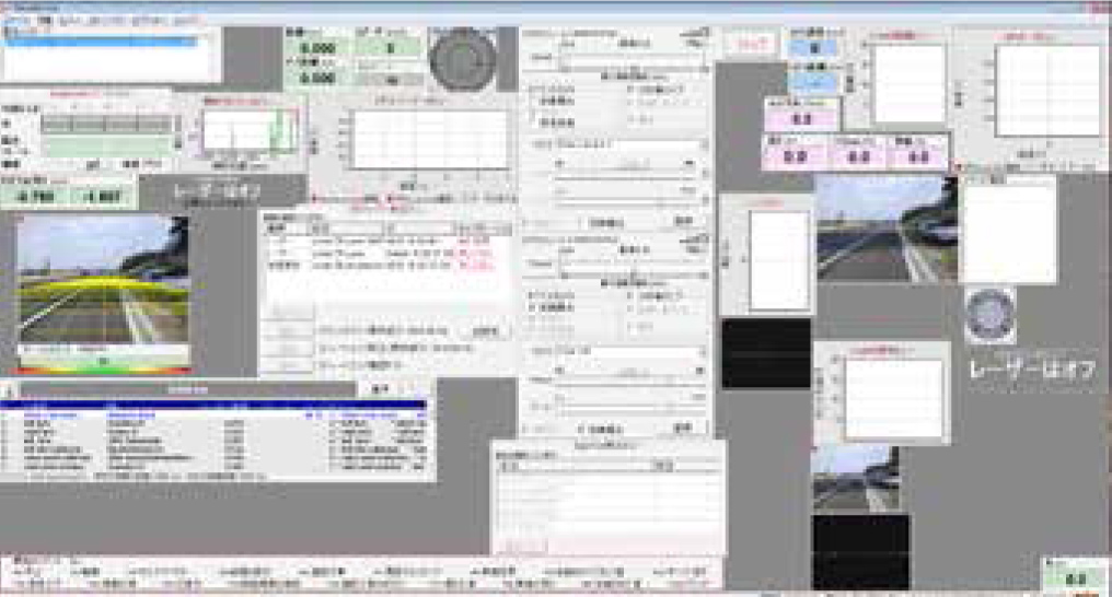
| Hawkeye Onlooker Live software is an interactive, real-time acquisition control interface that is capable of simultaneously controlling all inputs from any Hawkeye system, from a single software application. The software runs on a dedicated computer in the vehicle or on a laptop-based system, with a fully customisable layout. The network control interface enables real-time result reporting and the capability to progressively add new Hawkeye modules,without the need for additional software. |
| Features |
|
| Software capability |
|
|
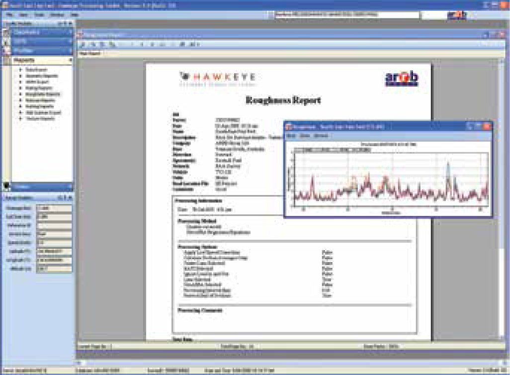
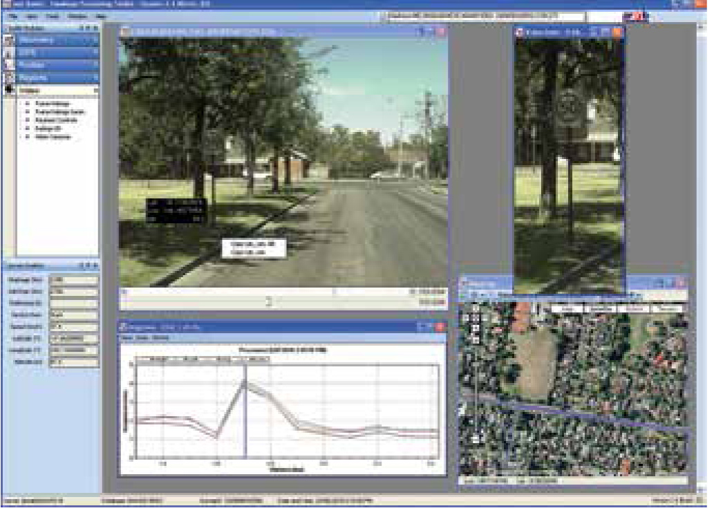
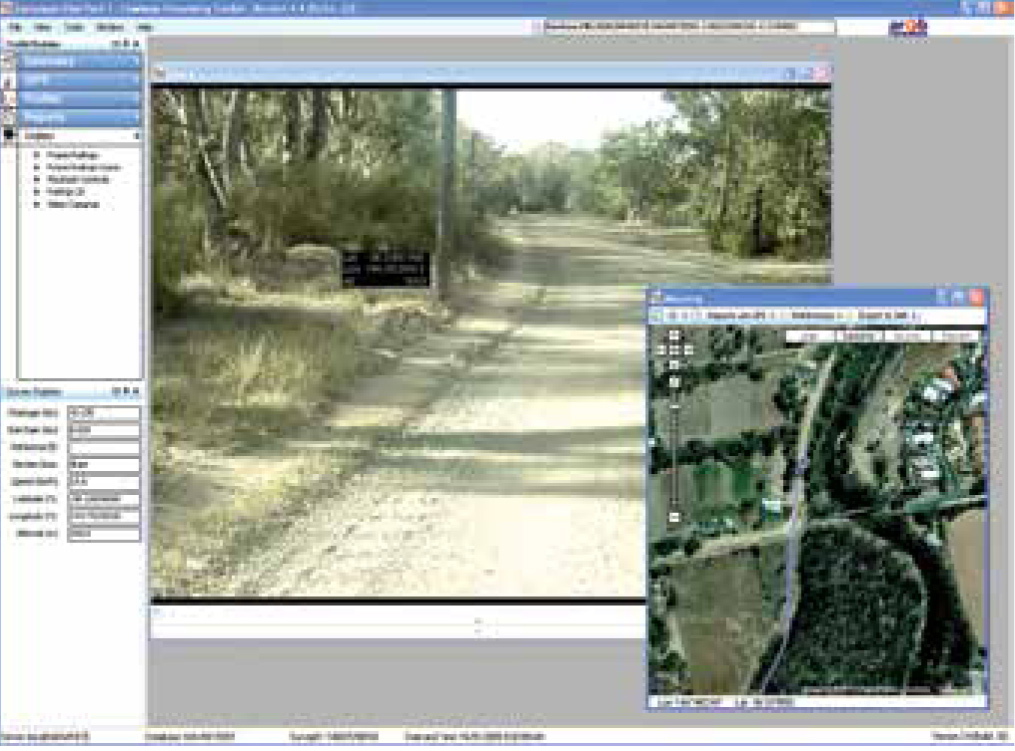
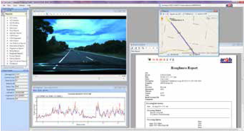
| Processing Toolkit - Analysis software |
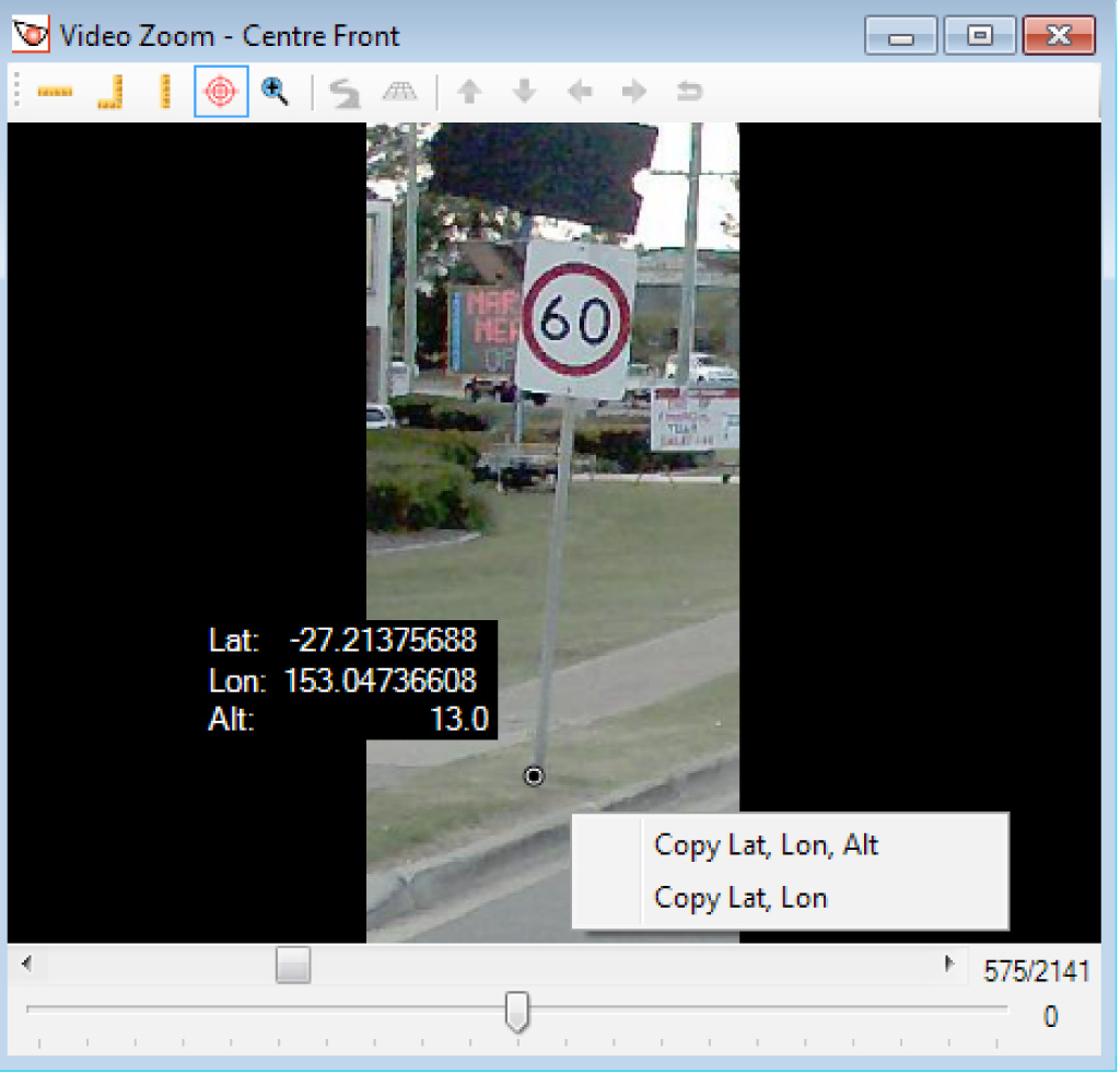
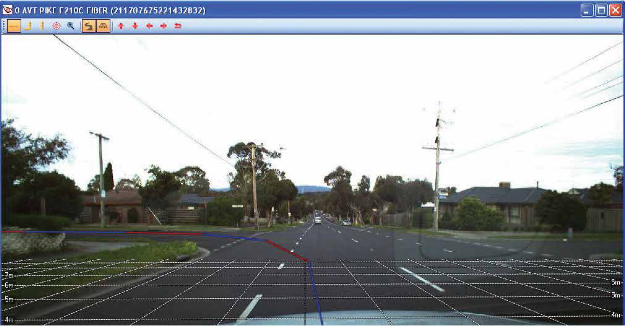
| The easy-to-use interface of Hawkeye Processing Toolkit features an integrated image viewer and centralised database to review all collected survey parameters. The software can be used to review and rate individual video frames against chainage and GPS, save images to file and zoom-in to inspect areas of interest. Multiple images can be assessed simultaneously and the road can be ‘driven’ at a rate selected by the operator. |
| Features |
|
| Software capability |
|
|
Hawkeye Data Viewer, viewing only software, is also available. The Hawkeye software suite is maintained by a large team of software developers and testers, with new releases occuring approximately every 8 weeks. ARRB prides themselves on integrating features based on customer feedback, and we encourage all of our clients to submit their comments or suggestions for improvements. |
Our Services
- Building Material
- Road Roughness Test
- Bridge Load Test
- Field Density Test
- Coarse & Fine Aggregate
- Plate Load Test
- Rebound Hammer Test
- Pile Load Test
- Soil Investigation Test
- Water Testing
- Video based classified traffic survey
- ATCC based classfied traffic survey
- Origin Destination and commodity Movement
- Turning Mment Survey
- Axle Load Survey
- NSV(Network Vehicle survey)
- FWD(Falling weight Deflectometer Test)
- Safety Audit
- Lidar Survey
- Other Testing Facilitys